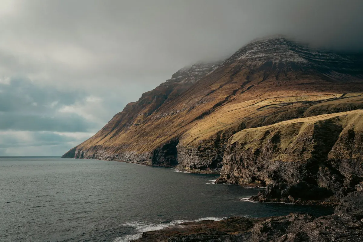
Stand at the base of a sea cliff and you feel a horizontal argument: the sea pushing in, the land holding on. Stand on a mountain ridge and the argument turns vertical: rock rising, gravity pulling it down. Same planet, same minerals, same rain falling on both. What differs is which process has the upper hand, and how long it has held it.
That is the whole trick of comparing coastal and mountain scenery. You are not comparing two kinds of beauty. You are comparing two sets of forces, running at different speeds, on different materials.
Rock Type Sets the Rules Before Anything Else
Before you admire a shape, look at what it is made of. Granite is massive and stubborn, with few planes of weakness. That is why granite coasts — Cornwall, Brittany, the Maine shore — break into blocky headlands with small coves wedged between them, and why granite mountains like those around Yosemite hold sheer walls instead of crumbling into slopes.
Chalk and limestone behave differently. They dissolve slowly in slightly acidic rainwater, so joints widen into gullies, caves and dry valleys. The white cliffs of Dover and the cliffs of Dorset are chalk: bright, smooth and prone to sudden collapse along vertical joints.
Then there are layered rocks — sandstone, shale, mudstone. Each layer has its own hardness, so erosion picks them apart unevenly. The Grand Canyon is a masterclass in this: hard sandstone and limestone form ledges and cliff bands, soft shale erodes into slopes between them, and the whole stack reads like the pages of a book.
Two Dials: Uplift and Erosion
Think of every landscape as a balance between two dials turned up or down. The first is uplift, the rate at which the crust rises. The second is erosion, the rate at which rock is removed.
Mountains exist where uplift wins, at least for a while. Continental collisions raise ranges like the Himalaya. Subduction of one plate beneath another builds the Andes. Faulting lifts blocks like the Sierra Nevada. Hotspots pile up volcanic islands like Hawaii.
Coasts often form where the crust is quiet or being stretched, so erosion and sea level get the final say. But not always. Parts of western Scotland show raised beaches, stranded above the present shoreline because the land rose after the weight of ice was removed. Sea level itself has risen and fallen many times, which is why some coastlines look drowned — Chesapeake Bay is essentially a flooded river valley.
Where uplift is fast and the rock is hard, you get sharp, young ranges such as New Zealand's Southern Alps. Where uplift slowed long ago, you get rounded, worn ranges like the Appalachians. Both are mountains. Only one still looks fresh.
The Tools of Erosion Work Differently
On a coast, the main tool is wave energy concentrated at the base of the land. Waves cut a notch at the high-tide line. The cliff above, now unsupported, collapses. The debris is dragged away, and the process repeats. The cliff retreats, leaving a gently sloping wave-cut platform behind it. Headlands absorb most of the energy because waves bend toward them; bays sit in relative calm and collect sand and shingle.
That produces a recognizable sequence on a single headland:
- Crack. Waves exploit a joint, a fault or a soft bed of rock.
- Cave. The crack widens into a hollow at the base of the cliff.
- Arch. Two caves meet from opposite sides, punching a hole through the headland.
- Stack. The arch roof collapses, leaving a pillar standing offshore.
- Stump. Waves reduce the pillar to a low, wave-washed rock.
Mountains erode with different equipment, and gravity does the hauling. Freeze-thaw action splits rock as water expands in cracks overnight; the pieces tumble into talus slopes. Rivers cut steep V-shaped valleys and carry the debris downstream. Glaciers, where they exist, grind out broad U-shaped troughs with flat floors and near-vertical sides. Landslides and debris flows move material in sudden, dramatic pulses.
Contrasts You Can Read From a Viewpoint
Once you know the processes, a few comparisons become almost automatic:
- Slope angle. Coastal cliffs are often near-vertical because undercutting removes support from below. Mountain slopes are usually angled, because debris has to travel downhill and settles where it can.
- Line of the skyline. Coasts tend to give a level horizon broken by headlands. Mountains give an irregular profile of peaks, cols and ridgelines.
- Sediment. Coastal erosion produces beaches, spits and barriers that shift with every storm. Mountain erosion produces scree, alluvial fans and braided riverbeds.
- Age of the surface. A retreating cliff exposes fresh rock constantly. A mountain summit may have been exposed for thousands of years.
- Vegetation. Salt spray and wind prune coastal plants into low, wind-shaped mats. Altitude and cold do something similar on mountains, which is why coastal heath and alpine tundra can look oddly alike.
Where the Two Landscapes Meet
The most dramatic scenery appears where coasts and mountains overlap. Fjords are the classic case: glaciers carve deep U-shaped valleys while sea level is low, then the sea floods them as ice retreats, leaving steep walls that drop straight into deep water. Norway, Chile, New Zealand's South Island and parts of Alaska all show this combination.
Coastal mountain ranges create a second kind of overlap. Because the land is steep and the rainfall is heavy, rivers deliver enormous amounts of sediment to the shore, building broad beaches and fans right at the foot of the hills. The Pacific coast of North America and the west of Scotland both show this pattern of hard rock, heavy rain and short, energetic rivers.
Reading It Yourself: A Practical Habit
Next time you are on a cliff path or a mountain trail, spend ten minutes doing four things. First, identify the rock and look for its weaknesses — joints, bedding planes, faults. Second, decide which direction the material is moving: sideways into the sea, or downhill under gravity. Third, look for the signs of retreat or removal, such as wave-cut platforms, talus, or fresh scars on a slope. Fourth, notice where plants have taken hold, because vegetation marks the places where erosion has paused long enough for soil to form.
Do that on a handful of coastlines and a handful of ranges and the pattern becomes obvious. Coasts are shaped mostly from below, at the waterline, in a contest decided by wave energy and rock resistance. Mountains are shaped mostly from above and within, by ice, rain and gravity working on whatever the crust has lifted. The scenery is different because the questions being asked of the rock are different.
Photo: Raul Ling / Pexels